The second session of our Lunch and Learn series focused on lessons learnt on our Roads component’s Covid Response Intervention. This intervention supported the road sector Ministries, Departments and Agencies (MDAs) in their early response to the Covid-19 pandemic, prioritising maintenance interventions on routes critical to the supply of food and fuel.
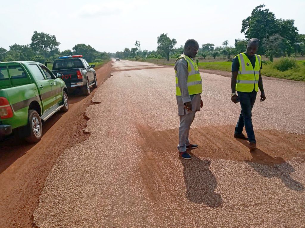
The intervention-support process had a number of steps. The first was to identify key Covid-19 response routes on the Federal Road Network (FRN) where the free flow of traffic was required to maintain the flow of food and fuel products. Next, a rapid driven survey was carried out for key routes to identify serious distresses or bottlenecks likely to cause problems to traffic flow. This rapid survey work was a joint effort between UKNIAF and the Federal Roads Maintenance Agency (FERMA). During the survey, the ‘bottleneck’ sites were assessed in detail to identify palliative measures. Cross-cutting considerations such as the safety of route for women, the importance of the route for livelihoods of local poor, and climate impacts on local communities (e.g. flooding) were also taken into consideration.
Prioritisation Methodology
A NIAF-developed base map of the federal road network formed the foundation for the Covid-19 response work. The base map was overlaid with information on route importance, road condition, traffic data, and details of agricultural zones and facilities. This additional information helped to prioritise the key routes. Some 14,500km of key agricultural and economic routes were initially identified by FERMA and the Federal Ministry of Works and Housing (FMWH) and this required prioritisation to focus the survey activity on the highest priority routes. Higher priority scores were given to important routes in poor condition, close to or supporting an agricultural facility.
Mapping Survey Data
The surveys took place over a two to three-week period and, in total, covered over 6,000 km of highway, with survey teams stopping at over 1,000 sites for more detailed inspection, and in the process collecting over 3,000 images of road-related distresses. Due to the sheer volume of data collected, UKNIAF developed an electronic ‘Data Viewer’ reporting tool that brings together all of the data for a route in a readily accessible format. It allows engineers and managers to obtain a clear picture of the overall condition of the route, and to focus on particular distresses or sections of route as required to inform decision-making.
Lessons Learnt
Collaboration: The roads sector is politically sensitive so, while we worked largely with FERMA on the surveys, we ensured that both FERMA and FMWH contributed data and information to the project, and were consulted regularly throughout. We ensured sufficient local knowledge and capability were available, which is an essential component of sustainable development. Good relations were maintained with relevant MDAs and this gave them the confidence to work with us. Ongoing communication meant that there were no suspicions regarding hidden agendas. The Roads Team also ensured continuity with existing procedures rather than reinventing the wheel.
Reaching out to stakeholders and being open to working with other players was a significant foundation of this project. Stakeholder engagements ensured a good understanding of what is happening in the sector and meant that we did not have to replicate existing work. It also provided the opportunity for us to announce UKNIAF’s presence in the sector and this led to opportunities to explore further areas of collaboration. Some of the stakeholders engaged with include FMWH, Federal Ministry of Agriculture & Rural Development (FMARD), FERMA, World Bank Rural Access and Agricultural Marketing Programme (RAAMP), UKAID’s PROPCOM and LINKS programmes.
More Cross-Cutting Considerations: More granularity will be required in subsequent surveys to inform the prioritisation process. Some examples include drilling down on the types of crops, economic corridors, special agricultural processing zones and sectors more broadly that are conducive for pro-poor and pro-women, jobs and livelihoods and well-being.